Research & Rationale

Geospatial analysis for user-testing site selection

This page brings together population density, transportation, healthcare access, land-use characteristics, and competitor listing activity to identify suitable locations for microhousing user testing and market research in Metro Manila.

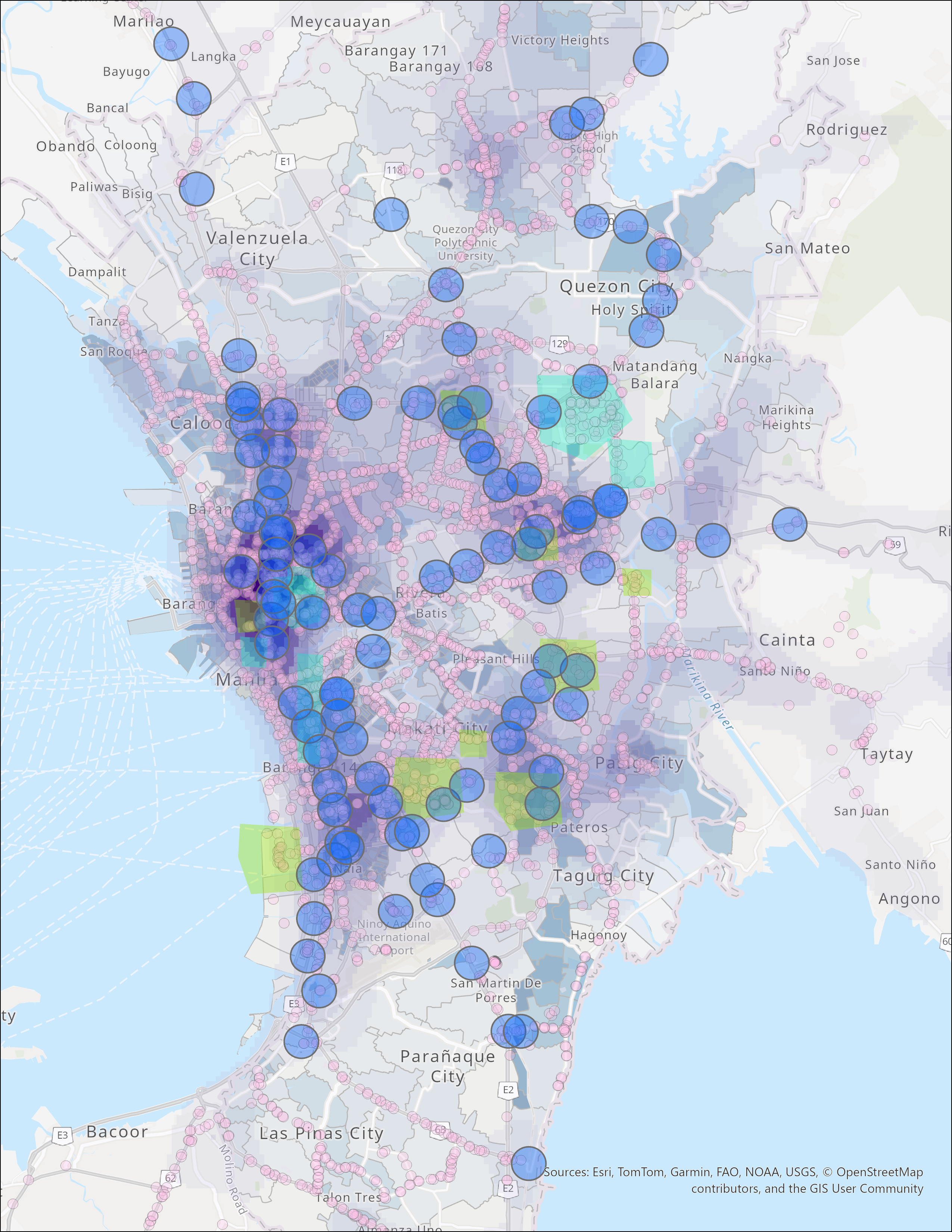
This research identifies suitable locations for user testing of a microhousing rental platform and for market research on competing platforms in Metro Manila, Philippines. The analysis integrates transportation infrastructure, healthcare access, population density, and land-use characteristics into a composite spatial framework, then compares that framework with competitor listing concentration to identify where demand, accessibility, and market activity are most likely to overlap.

The research focus is straightforward: identify where density is strong enough to support microhousing demand, where transportation and healthcare access make compact living more practical, and where market activity suggests that user testing can generate meaningful product insight. In practice, this means using geospatial analysis to narrow the metro into a smaller set of districts where density, accessibility, proximity to business and university districts, and competitor behavior overlap most clearly.

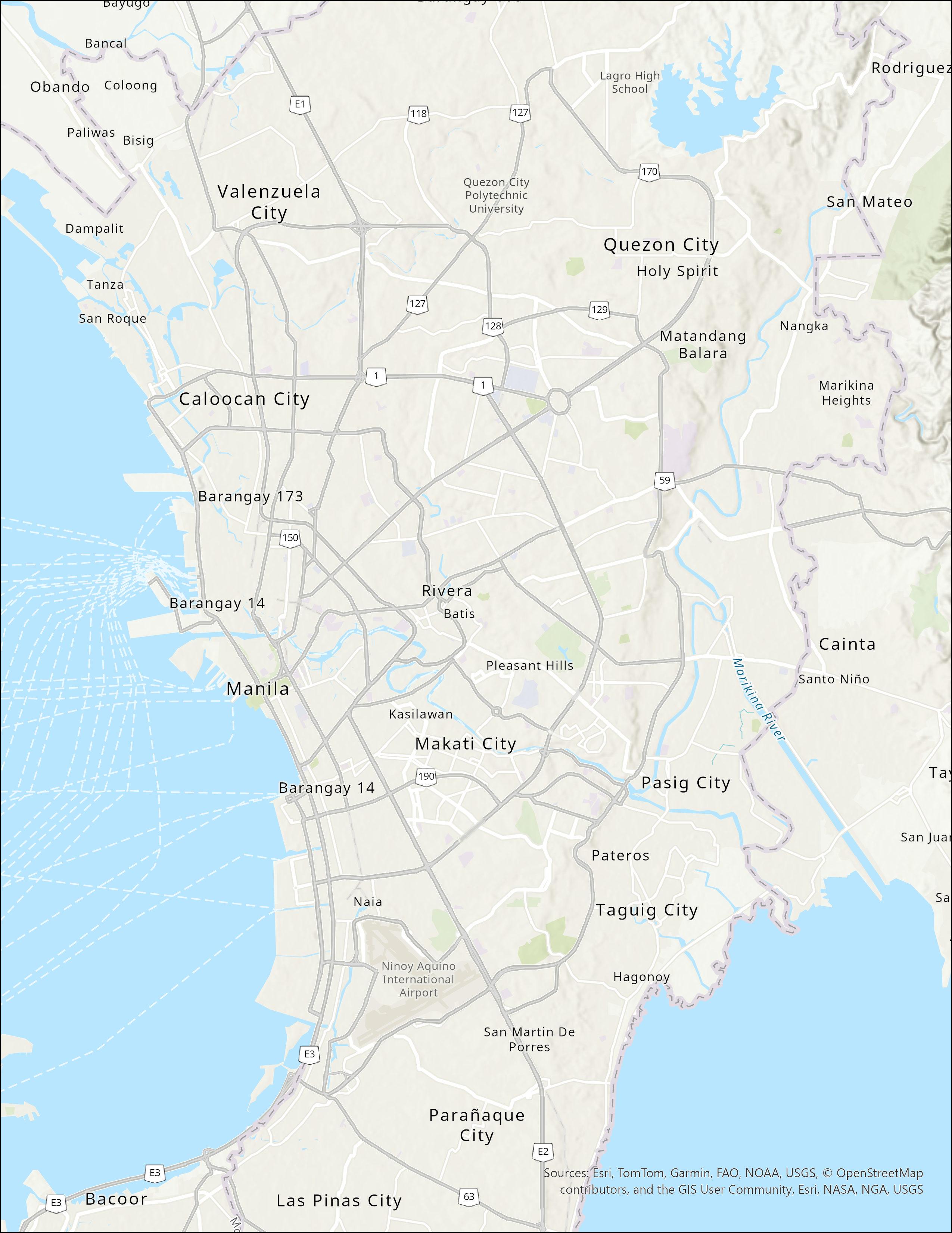
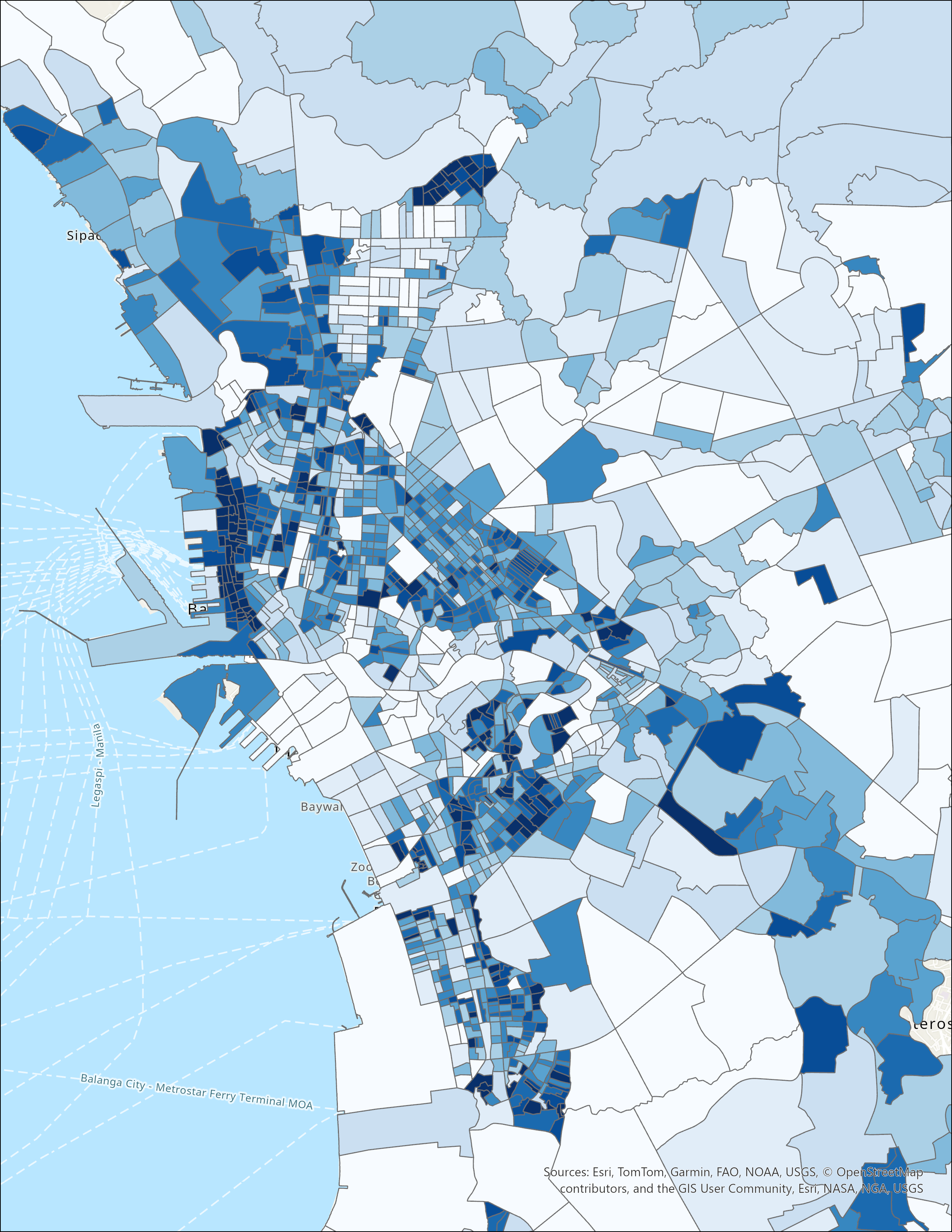
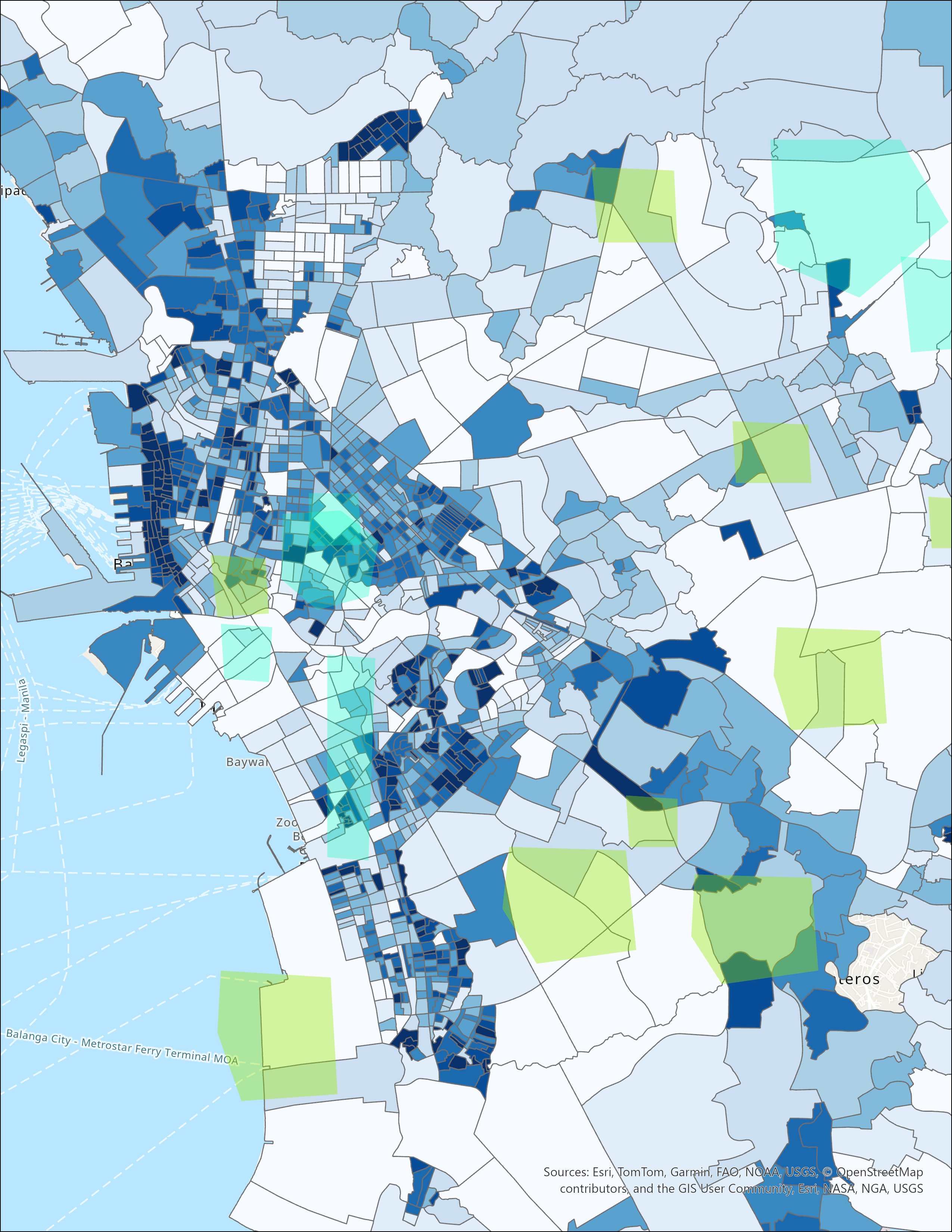
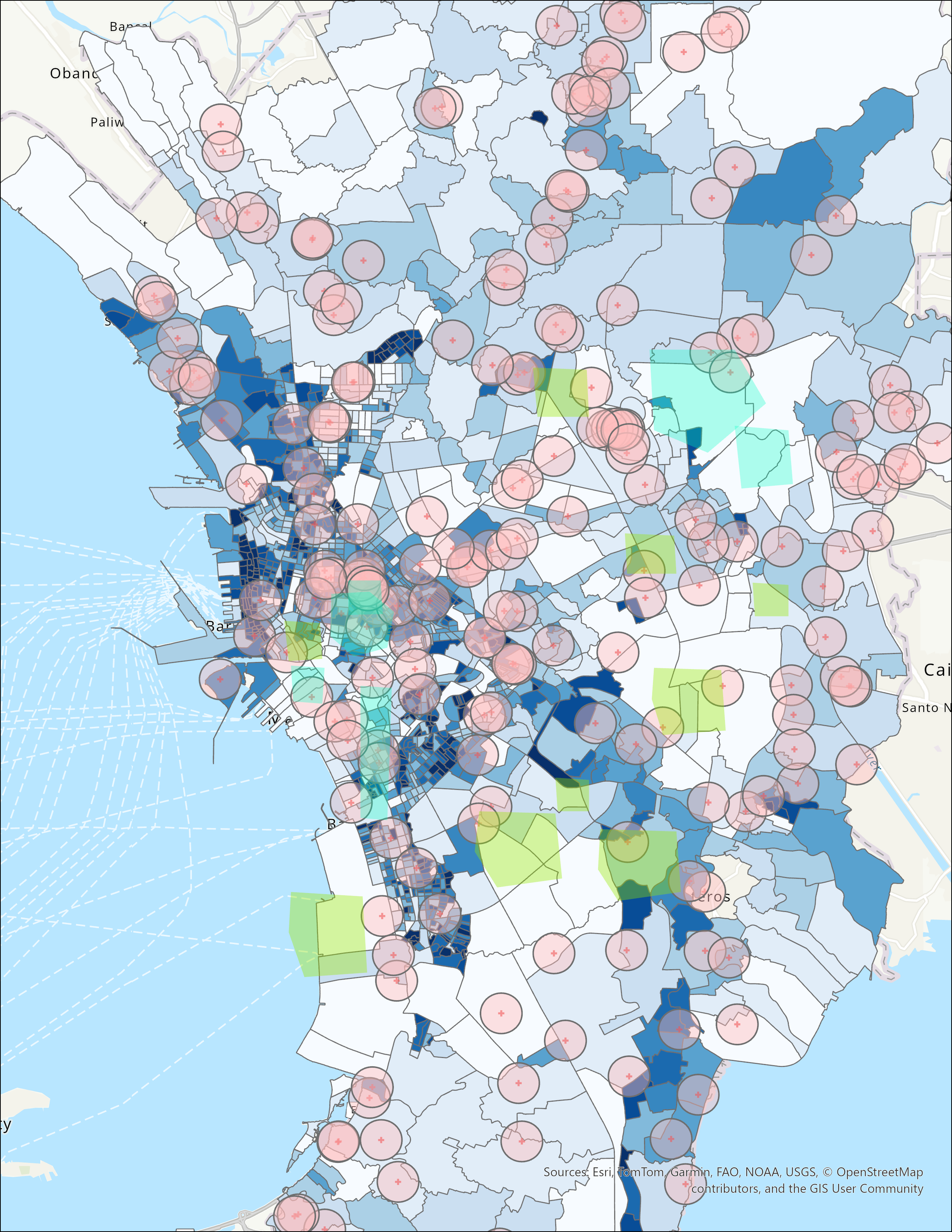
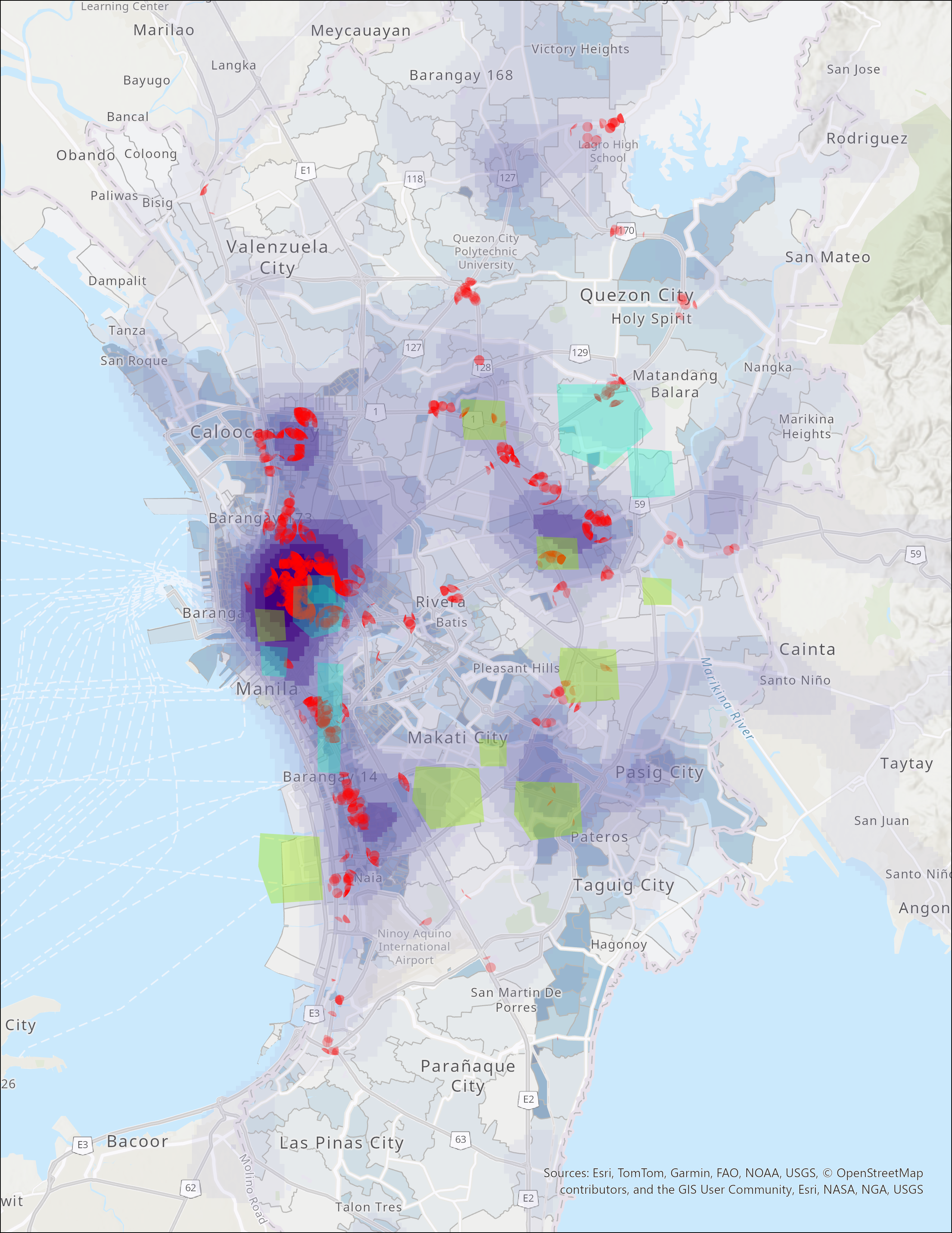
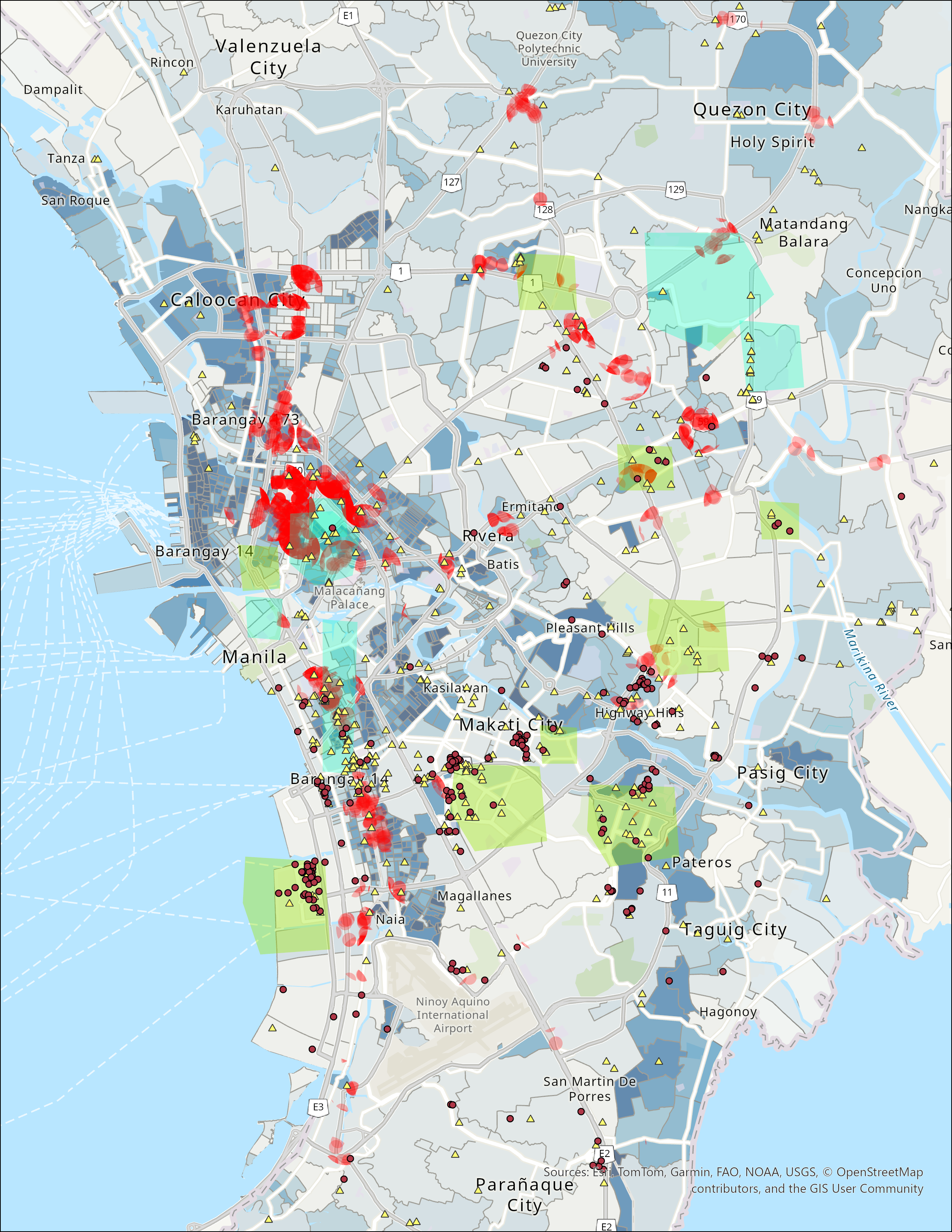
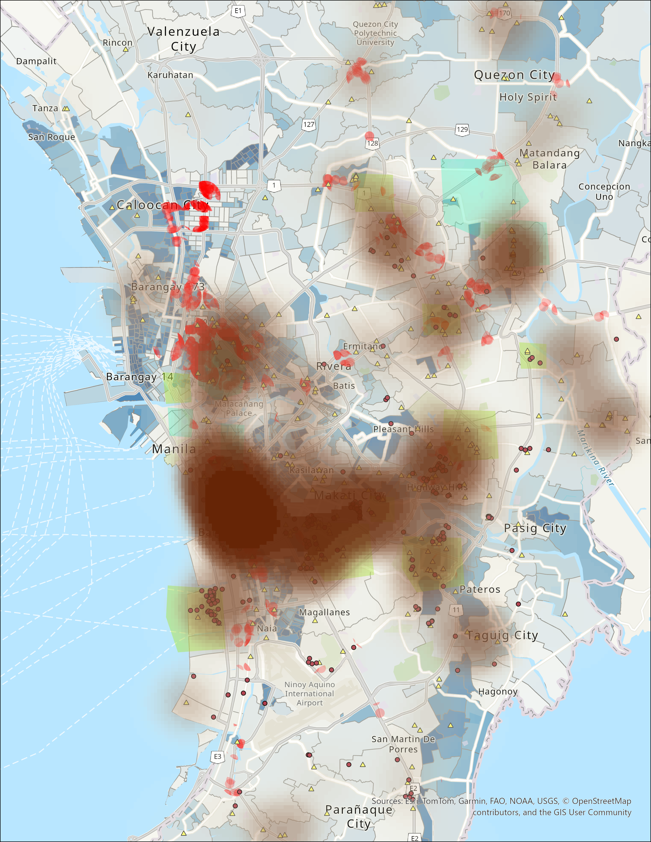
The map frames below work together as a geospatial site-selection analysis. Each one contributes a different spatial signal to the question of where Roomie should conduct user testing and market research in Metro Manila.

Next Steps

Threat and Rental Price Analysis

The current site-selection work establishes demand, accessibility, and competitor context. The next research phase should stress-test those candidate locations against risk and resilience variables that materially affect whether a microhousing market is workable over time.

Crime and safety analysis

The next layer should evaluate crime rates and crime incidents across candidate districts to determine whether strong demand and accessibility are offset by safety concerns. This should ideally include both overall crime patterns and the types of incidents most relevant to renters, mobility, and neighborhood trust, including traffic-related crime or safety risks that may affect everyday movement through target districts.

Flood exposure and damage history

Flood analysis should go beyond a static hazard layer. The team should examine time-series flooding patterns, severity, and historical damage where data is available, since recurring flood exposure can materially weaken the suitability of otherwise attractive user-testing locations.

Refine final site selection

Once crime and flood-risk layers are incorporated, the team can compare high-demand accessible districts not only by market fit but also by operational resilience. That final screen should produce a smaller set of user-testing sites with stronger justification for pilots, surveys, and partnership outreach.

Sources

Administrative boundaries and population density: Philippine Standard Geographic Code (PSGC) by the Philippine Statistics Authority (PSA), used as the administrative and population reference for district-level analysis, together with Philippines - Subnational Administrative Boundaries via HDX, used for boundary alignment and spatial mapping. PSA website & HDX dataset

Business and university districts: Based on the official estate boundaries defined by each business district's operator or management body, including Makati Commercial Estate Association (MACEA) for Makati CBD; Fort Bonifacio Development Corporation (FBDC) / Bonifacio Estate for BGC; Ortigas Center Association for Ortigas Center; Rockwell Land for Rockwell Center; SM Prime / Bay City reclamation master plan for Bay City – MOA Complex; Megaworld Corporation for Eastwood City and Vertis North; Araneta Group for Araneta City; and Alveo / Filinvest for Alabang – Filinvest City. University districts are based on each institution's official campus boundaries. Coordinate system: WGS84 (EPSG:4326).

Bus: OpenStreetMap (© OpenStreetMap contributors)
Train: OpenStreetMap (© OpenStreetMap contributors)
Jeepney: General Transit Feed Specification (GTFS) feed for Metro Manila GitHub feed & GTFS website
Hospitals: Philippine DOH — National Health Facility Registry (NHFR) DOH website